How to Read a Marine Weather Forecast (California Edition)
Why Marine Weather Matters So Much in California
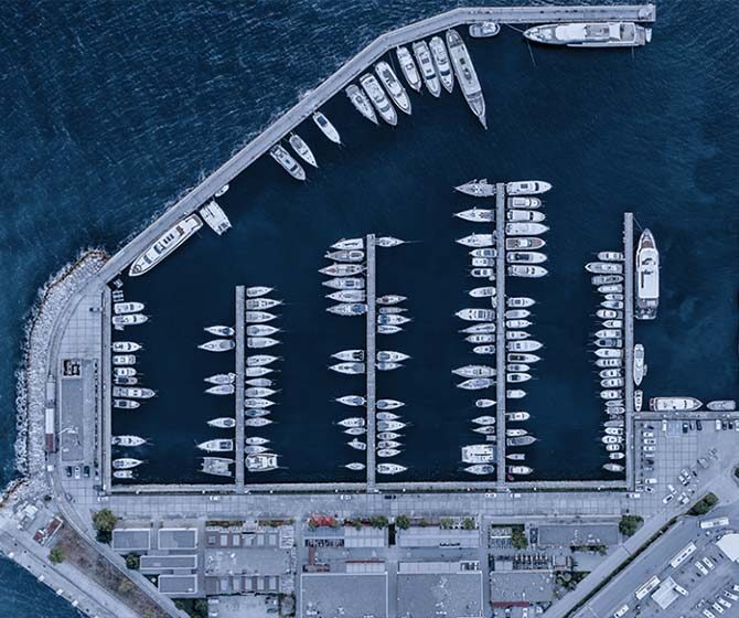
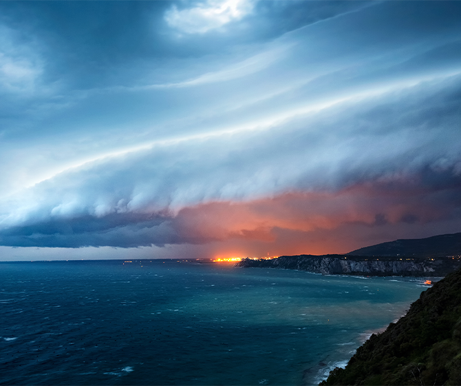
California waters are wild — between Santa Ana winds, afternoon sea breezes, coastal upwelling, Pacific storms, fog, and long-period ocean swells, conditions can change in minutes. Knowing how to read marine weather isn’t just smart — it’s essential for safe boating around our coastlines.
The U.S. Coast Guard (USCG) and the National Weather Service (NWS) emphasise that many weather-related boating accidents are preventable when skippers check and understand official marine forecasts — including wind, sea state, and hazard warnings.
The Forecast Sources California Boaters Should Use
These are the official, most reliable sources — and they cover all regions of the California coast.
NWS Marine Forecasts (via NOAA / weather.gov)
Covers local zones such as San Diego, Los Angeles / Oxnard, Monterey Bay, San Francisco Bay, and more. Use these for up-to-date coastal and offshore conditions.
You can also get an hourly marine forecast for a single point.
NWS Marine Weather Statements, Small Craft Advisories, Warnings & Watches

Issued when hazardous conditions (wind, high seas, fog, storms) are forecast. Boaters should pay special attention to these before and during a trip.
- A watch informs mariners when a significant or hazardous weather event is possible, but not imminent during the next 12 to 36 hours.
- An advisory indicates that a hazardous weather event is coming, imminent, but does not meet warning criteria.
- A warning alerts mariners that a significant or hazardous weather event is likely, imminent, or occurring, and is a threat to life and property.
Learn more here.
The NWS also issues weather statements to provide mariners with details on significant or potentially hazardous conditions not otherwise covered in existing marine warnings and forecasts as well as risk assessments for rip currents and other beach hazards.
Detailed information about marine weather watches, advisories, and warnings can be found here.
Real-time Buoy & Observation Data
Many NWS forecast pages link to observations (wind, wave, sea temperature) which help confirm forecast conditions before departure.
Local Forecast/Zones per Region
for example:
Southern California & Channel Islands coast via the Los Angeles/Oxnard Forecast Office Weather.gov
Monterey Bay through the San Francisco/Monterey Forecast Office Weather.gov
Pro tip: Always check the forecast zone for your area — “outer coastal waters,” “inner waters,” or “harbour/nearshore” — as each zone’s conditions can differ significantly.
Key Terms Every California Boater Must Know
The marine forecast provides several important data points. Here’s what to watch for — and why they matter.
Wind Speed & Direction (knots)
Most forecasts give wind speed as a range; for example, “NW 10 to 15 kt.” Strong winds can create chop, swell, or difficult handling conditions.
You can find the latest advice for California here.
Wave / Sea State — Height & Period

- Wave/Sea Height (ft or “seas 2-3 ft”, etc.) — gives you an idea of the roughness of the water.
- Swell or Wave Period (seconds) — often the most critical: long-period swells (e.g. 10–15+ sec) are powerful and can create steep, rolling seas, even if wave height is low. Many boating-weather guides highlight that period + direction can pose bigger hazards than height alone.
You can find the latest video & audio for safe boating each week here.
NWS warns that understanding a marine forecast is critical to safe boating. Weather and wave conditions can change suddenly, catching boaters off guard and creating life threatening conditions.
Hazard Warnings & Advisories
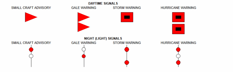
- Small Craft Advisory — a warning that conditions (wind, seas, swell) may be hazardous for small or recreational boats.
- Gale / Storm / Special Marine Warnings — for high winds, storms, big seas, etc. These demand high respect.
- Fog, Heavy Rain, Squalls, and Other Weather Hazards — conditions that reduce visibility or change quickly. Many NWS forecasts include notes on visibility or special warnings.
Reading a California Sample Forecast — What to Watch For
Here’s a simplified example of a real NWS marine-zone forecast for Southern California coastal waters:
N wind 10-15 kt, seas 2 to 3 ft. Wind waves NW 2 ft at 5 seconds. W swell 2 ft at 11 seconds.
What this tells you:
- N wind 10-15 kt → moderate breeze: expect some chop but likely manageable if boat and crew are experienced.
- Seas 2–3 ft + Wind waves 2 ft at 5 sec → nearshore wave action & chop — expect bumpy ride.
- W swell 2 ft at 11 sec → longer-period swell: may contribute to rolling, especially offshore or near kelp beds/reefs.
Overall: good to cautious: fine for nearshore cruising with caution; for offshore trips or small vessels, maybe postpone or check again later.
If instead the forecast issued a Small Craft Advisory, or said “Seas 5–8 ft, swell 6 ft at 8 sec, NW winds 20–25 kt”, that would be a strong signal to reconsider or postpone your trip.
LOKKET Takeaway
Understanding marine weather gives you more than just peace of mind — it lets you plan smarter, sail safer, and avoid bad trips before they even start.
Better awareness = better boating. California waters reward captains who prepare — and at LOKKET, we’re here to help every boater stay connected, informed, and confident from dock to destination.
Summary of what we went over:
Check the latest official NWS/NOAA marine forecast for your zone before casting off.
Pay attention to wind, swell height & period, wave state, and alerts — the forecast range doesn’t guarantee calm water.
If a Small Craft Advisory, Gale Warning, or other hazardous weather alert is active — consider waiting for a better window.
Combine forecast reading with real-time observations (buoy, tide, current, sky conditions) before and during your outing.
You can find more boating guides from us here
Be safe, stay prepared, and enjoy every moment on the water.
— The LOKKET Team